
Still reeling from Hurricane Laura, Gulf Coast braces for Hurricane Sally
MONROE, La. — The Gulf Coast is looking down the barrel of another violent storm as newly formed Hurricane Sally churned north, threatening to bring heavy rain, howling winds and a dangerous storm surge from Louisiana to Florida.
The hurricane comes less than three weeks after Hurricane Laura carved a wide path of destruction that left more than a third of Louisiana a disaster zone.
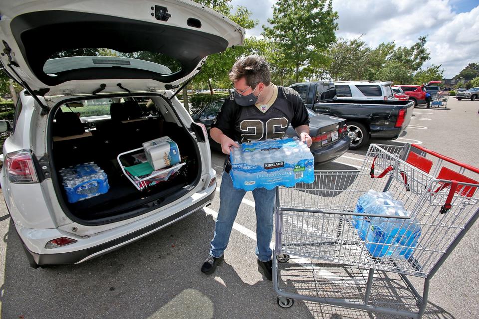
“I know for a lot of people this storm seemed to come out of nowhere,” said Louisiana Gov. John Bel Edwards. “We need everybody to pay attention to this storm. Let’s take this one seriously.”
The National Hurricane Center said Sally is likely to bring "life-threatening storm surge, hurricane-force winds and flash flooding" along the Gulf Coast as soon as Monday.
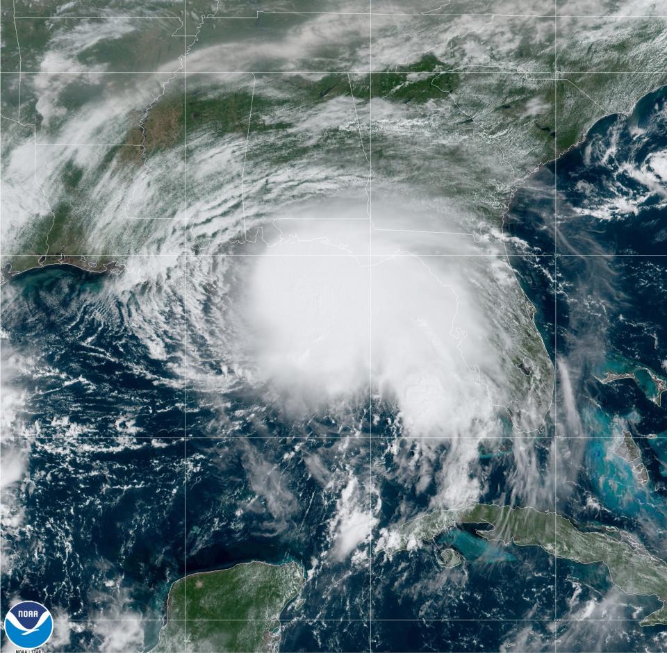
The storm is forecast to make landfall in southeastern Louisiana early Tuesday as a Category 2 hurricane, however, the Hurricane Center said it was still too early to determine where Sally's center would move onshore.
Hour by hour: Hurricane Laura raged outside my front door. I hunkered down for the night.
Hurricane warnings are in effect from Morgan City, Louisiana, to the Alabama and Florida border, including New Orleans, the Hurricane Center said.
As it lurches over the Gulf Coast, Hurricane Sally could bring 8 to 16 inches of rain, with some areas seeing up to 24 inches. "Life-threatening flash flooding is possible. In addition, this rainfall will likely lead to widespread minor to isolated major flooding on area rivers," forecasters at the Hurricane Center said.
Sally is the seventh hurricane of 2020 Atlantic hurricane season.
Edwards warned people to prepare for the storm immediately. However, Louisiana already is sheltering about 13,000 Hurricane Laura evacuees, most of whom are in hotels in New Orleans, which is in the potential path of Sally.
"New Orleans is better prepared for a hurricane than she's ever been before, but if you get 18 inches of water in 10 hours, I think Aspen, Colo., would probably flood. So I'm concerned, but not paralyzed by it," he said.
Mayor LaToya Cantrell issued a mandatory evacuation order for Orleans Parish residents living outside of the parish’s levee protection system, and residents of Grand Isle, Louisiana, were also told to evacuate.
"Residents need to take this storm very, very, very seriously," said New Orleans' Homeland Security and Emergency Preparedness Director Collin Arnold.
Tens of thousands more also were displaced from their homes after Laura. And more than 82,000 people remain without power in Lake Charles and southwestern Louisiana. More than 210,000 households don't have clean drinking water.
Benjamin Schott, the meteorologist in charge of the National Weather Service office in New Orleans, said Louisianans in the southeastern part of the state shouldn't compare Sally to previous storms Barry, Cristobal and Marco, which ended up to be duds.
"I do not believe we'll be that lucky this time," Schott said.
More on Laura: 'Extraordinary work' underway to rebuild electric, water, cell grid after Hurricane Laura
After Sally makes landfall, it is expected to move slowly over Mississippi, Alabama and Florida's Panhandle on Tuesday into Wednesday. At 11 a.m. CDT on Monday, the hurricane had 85 mph winds and was about 135 miles east-southeast of the mouth of the Mississippi River. It was moving west-northwest at 6 mph.
In Mississippi, officials warned residents the storm would coincide with high tide and could bring significant storm surge
“It needs to be understood by all of our friends in the coastal region and in south Mississippi that if you live in low-lying areas, the time to get out is early tomorrow morning,” Gov. Tate Reeves said late Sunday.
Mandatory evacuation orders were in effect for Hancock County on Monday morning for residents living in low-lying areas, on or near water sources and in mobile homes.
The Hurricane Center said the area from the mouth of the Mississippi River to Ocean Springs, Mississippi could see up to 11 feet of storm surge.
Winona "Bebe" McElroy and her husband Victor were staying in their home in Cocodrie, Louisiana, outside of the levee system on Sunday. Winona McElroy said she didn't expect the weather to get bad until Monday afternoon.
The two brought their two boats to a farm to protect them from the storm.
"We take every storm in the Gulf seriously," she said. "That's why we're spending our Sunday afternoon taking our boats to safe harbor, inside the levee protection area."
McElroy said they will monitor the waters and leave if it appears their truck may get trapped by the waters.
"We know at what point the truck can't get out," she said.
South Florida already took the early brunt of Sally's power over the weekend, soaking the southern Florida Keys. Nine to 12 inches of rain fell Saturday morning to Sunday morning, prompting a flood advisory.
Key West reported a little more than 9 inches at midnight, its fifth-highest daily total. That included a one-hour total of almost 4 inches Saturday night. The National Weather Service office in Miami reported about 3 inches of rain in Florida Gardens in Palm Beach County on Saturday.
In the Panhandle, “The rain is going to be the main threat, along with the beaches, which will see lots of large, surface-breaking waves and a high risk of rip currents,” said Jack Cullen, a meteorologist with the National Weather Service in Mobile, Alabama.
The Pensacola area can expect to receive between 10 to 15 inches of rain and bursts of tropical storm force winds.
Meanwhile, four other storms are swirling in the Atlantic, which is seeing an especially active hurricane season. Hurricane Paulette is moving away from Bermuda as it makes its way east over the ocean. The East Coast could see some swells from the storm.
Rene, a tropical depression, is heading southwest but forecast to become a remnant low Monday. Tropical Storm Teddy is strengthening as it moves northwest, and could be a major hurricane by mid-week as it remains far off land northeast of Puerto Rico and southeast of Bermuda. Tropical Storm Vicki also formed Monday in the eastern portion of the Atlantic Ocean. Vicki, the 20th named storm of the season, is expected to be short-lived and poses no threat to land.
Contributing: John Bacon, USA TODAY; Dan Copp, Houma Courier; Annie Blanks, Pensacola News Journal; Lici Beveridge, Mississippi Clarion Ledger; and The Associated Press
This article originally appeared on USA TODAY: Hurricane Sally: Louisiana, Gulf Coast braces for another hurricane

