
UK weather: Met Office warning for thunderstorms and flood alerts on bank holiday Sunday
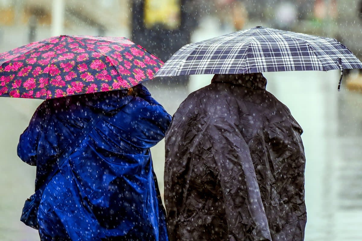
Weather warnings and dozens of flood alerts have been issued across England and north Wales, as thunderstorms are set to put a dampener on the bank holiday weekend.
More than an inch of rain could fall in just one hour as thunderstorms lash parts of England and Wales, forecasters have warned. Slow-moving showers and thunderstorms are expected to develop on Sunday afternoon, with 20-30mm of rain due to hit.
Hail and lightning strikes may also occur, with people warned to expect possible flooding, travel delays and power cuts.
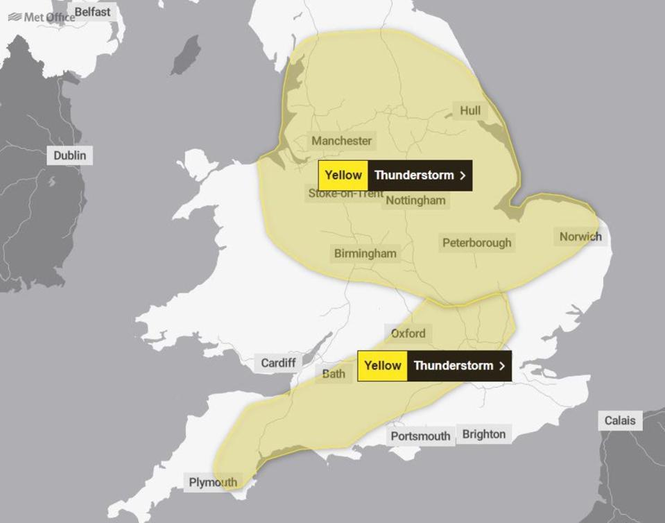
The Met Office has issued a yellow warning from midday until 8pm on Sunday across much of central and northern England and the north east of Wales. A further warning was later put in place across areas of south-west England and the Home Counties, lasting from 10am to 7pm.
Sudden flooding could create difficult driving conditions, or even lead to communities being cut off by road closures, with a small chance of homes and businesses becoming rapidly flooded or damaged by lightning strikes, forecasters said.
Trains and bus services could face cancellations and delays, with the chance of power cuts and other services to some homes and businesses being lost, the Met Office warned.
As much as 20mm to 30mm could fall over a few hours and there may be hail and lightning strikes.
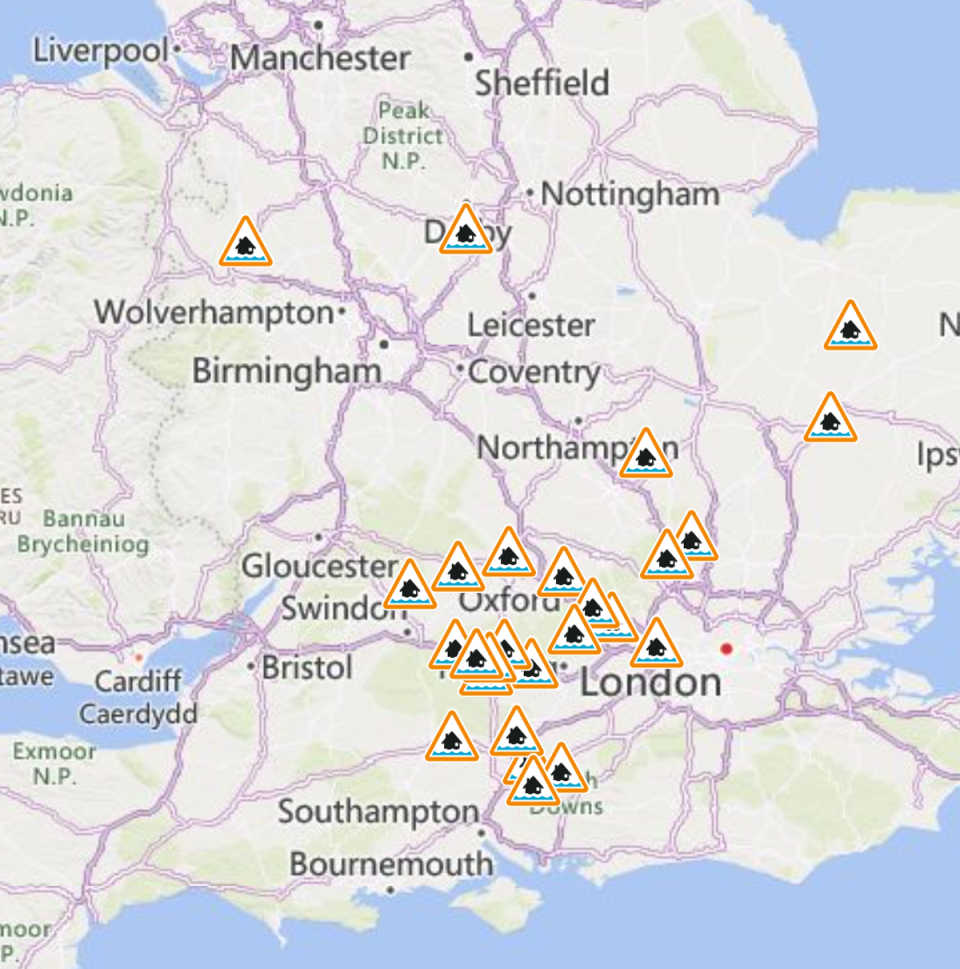
The Environment Agency has issued 26 flood alerts, meaning flooding is possible – mostly centred in southern England to the west of London, but also near Derby and Shrewsbury.
But the picture will brighten somewhat on Monday with drier conditions possible in parts of Wales, Northern Ireland and southwest England in the afternoon. A mix of “sunshine and showers” will be the case for many on Monday, forecasters said.
Forecaster Kathryn Chalk said: “There could be some disruption, especially for people travelling or out trying to enjoy the bank holiday weekend.
“So I’d say definitely keep an eye out on that. Some southern areas of England may also see a few heavy downpours, perhaps even the odd rumble of thunder as well.”
She added: “It’s just a more unsettled weather regime where the air’s unstable and with more heating in the land it helps develop a storm.”
MET OFFICE OUTLOOK
Sunday:
A cloudy start with spells of rain pushing northwards. Becoming showery into the afternoon with some sunny spells in between. The showers however, turning heavy and thundery at times. Temperatures around average.
Sunday night:
Showers gradually fading this evening in the south to leave clearer spells overnight. Spells of rain persisting in parts of Scotland, Northern England and Wales leading to a mild night.
Monday:
Cloudier conditions to start in the north, followed by scattered showers. These generally less widespread than on Sunday, but still turning heavy and thundery at times, especially across Scotland. Breezy.
Outlook for Tuesday to Thursday:
Remaining changeable with longer spells of rain followed by heavy showers on Tuesday. Sunny spells and frequent showers on Wednesday and Thursday. Feeling cooler for most and breezy at times.
Additional reporting by PA

